


|
We offer Alaska raft trips that offer scenic views, wildlife viewing, fishing, and whitewater.
Custom group Alaska rafting adventures are available on request. If have interested in something special or participating in an exploratory expedition, please contact us with your ideals or to see what plans are being made.
Kongakut River - 10 day Arctic National Wildlife Refuge Rafting Safari. Explore Alaska's remote Arctic National Wildlife Refuge (ANWR) by raft on the "river of caribou". Our trip coincides with the annual migration of the 130,000-strong Porcupine caribou herd and passes through some of the world's most pristine wilderness.
Lake Creek - 7 day Whitewater Rafting and Fishing Adventure. Our favorite fly-in wilderness adventure river, great combination exciting whitewater and great Alaska fishing. Lake Creek offers almost continuous Class II/III whitewater with a few Class IV rapids, five species of salmon, rainbow trout and arctic grayling.
Chulitna River - 4 day Denali Raft Adventure. An excellent family adventure and sampling of Alaska's best wilderness and geography at a casual pace. We travel through Denali State Park, upper Susitna Valley and take out near Trapper Creek, a historic gold mining town. |
|
|
|
 |
Alaska Maps
Some of the most current up to date topographic maps for Alaska are the National Geographic Trails Illustrated maps. Printed on waterproof paper makes them ideal for use in Alaska wet temperate rainforest environment. CLICK HERE: National Geographic Alaska Trails Illustrated maps.
Kenai Fjords National Park Maps - PDF format
 Resurrection Bay Maps - PDF format Resurrection Bay Maps - PDF format
Seward Maps - PDF format
Katmai and Lake Clark Maps - PDF format
Alaska Railroad Maps - PDF format
Alaska's Big Map
Alaska is big. Really big. It's hard for most people to understand just how large Alaska really is. To try to picture this vastness, take a look at this map graphic of Alaska superimposed over the lower 48 states (continental United States). The most important advice we can give you is "seeing less means seeing more". Many travelers don't realize just how long it can take to get from one location to another. You could easily spend your whole vacation just getting from one location to the next and not have time to enjoy what Alaska has to offer. If your time is limited, plan on visiting just one or two locations and take time to immerse yourself in Alaska's national history, wilderness and spectacular scenery.
Trails Illustrated Topographic Alaska Maps
Some of the most current up to date topographic maps for Alaska are the National Geographic Trails Illustrated maps. Printed on waterproof paper makes them ideal for use in Alaska wet temperate rainforest environment.
 Kenai Fjords National Park Trails Illustrated Map Kenai Fjords National Park Trails Illustrated Map
The map includes Kenai Fjords National Park, Kenai national Wildlife Refuge, Chugach National Forest, Harding Icefield, Nuka Island, Kachemak Bay State Park, Ragged Islands, Pye Islands, and more. |
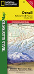 Denali National Park Trails Illustrated Map Denali National Park Trails Illustrated Map
The map includes the entire national park area, with a close up view of the area in an around Mount McKinley. It also includes information about Denali National Park and Preserve, as well as useful tips about animal encounters, river crossings, hypothermia, and more. |
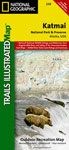 Katmai National Park Trails Illustrated Map Katmai National Park Trails Illustrated Map
This map includes Katmai National Park, Becharof National Wildlife Refuge, Becharof Wilderness Area, Alaska Peninsula National Wildlife Refuge, Alagnak Wild River Katmai National Preserve, McNeil River State Game Sanctuary, and more. |
 Kenai National Wildlife Refuge Trails Illustrated Map Kenai National Wildlife Refuge Trails Illustrated Map
Coverage includes Chugach National Forest, Kenai National Wildlife Refuge and Wilderness, Soldotna and Sterling; Skilak, Tustumena, Kenai lakes, Turnagain Arm, Swanson River and Swan Lake canoe routes. Resurrection, Johnson and Moose passes, and Seward Highway. |
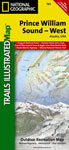 Prince William Sound West Trails Illustrated Map Prince William Sound West Trails Illustrated Map
Coverage includes Chugach National Forest, Whittier, Nellie Juan, College Fjord, Harriman, South Esther Island, Surprise Cove, Decision Point, Entry Cove, Chenega. Knight, Latouche, Elrington, Evans, Bainbridge, Culross, Esther, Perry islands, Port Wells, Bainbridge, and more.
|
 Prince William Sound East Trails Illustrated Map Prince William Sound East Trails Illustrated Map
Coverage includes Chugach National Forest, Nellie Juan-College Fjord Wilderness Study Area, Copper River Delta; Shoup Bay, Sawmill Bay, and Jack Bay state marine parks; Delta Habitat Area, Valdez, Cordova. Includes selected anchorages and kayak landings. |
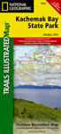 Kachemak Bay State Park Trails Illustrated Map Kachemak Bay State Park Trails Illustrated Map
Coverage includes Kachemak Bay State Park, Kenai National Wildlife Refuge, Kenai Fjords, Kenai Wilderness; Crooked Creek, Kasilof River, Anchor River Johnson Lake, Ninilchik, Clam Gulch, and Tustumena Lake. Detail maps of Halibut Cove Lagoon, Seldovia, and Homer. |
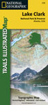 Lake Clark National Park Trails Illustrated Map Lake Clark National Park Trails Illustrated Map
This map includes Lake Clark National Park, McNeil River State Game Refuge, portions of Katmai National Preserve, Port Alsworth, Pedro Bay, Chekok, Iliamna, Newhalen, Kokhanok, Chinitna Bay, Chenik, Drift River, Lake Clark, Cook Inlet, Kamishak Bay, and Augustine Island. |
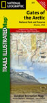 Gates of the Arctic National Park Trails Illustrated Map Gates of the Arctic National Park Trails Illustrated Map
This includes Gates of the Arctic National Park and Preserve, portions of Noatak National Preserve, Kanuti National Wildlife Refuge, Selawik National Wildlife Refuge, and Yukon Flats National Wildlife Refuge. Also included are Anaktuvuk Pass, Mount Ingstad, Bettles, Coldfoot and more. |
 Wrangell-St. Elias National Park Trails Illustrated Map Wrangell-St. Elias National Park Trails Illustrated Map
This map includes Wrangell - St. Elias National Park, along with Tetlin National Wildlife Refuge, portions of Chugach National Forest, the Bering Glacier, Chugach Mountains, Wrangell Mountains Kayak Island State Marine Park, McCarthy, Slana, and Glennallen. |
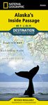 Alaska's Inside Passage Trails Illustrated Map Alaska's Inside Passage Trails Illustrated Map
Coverage includes Alaska's Inside Passage, Glacier Bay National Park, Tongass National Forest, Klondike Gold Rush National Park, Sitka National Historical Park, Misty Fjords, Admiralty Island, Tracy Arm-Fords, South Baranof Wilderness, and Prince of Wales Island. |
|
 |
Questions? -- Custom Tour Package Inquiry? -- Availability? -- Make Reservation?
1-907-205-5900 • Fax 1-907-205-5902
 |
 |
|
|