Kenai Fjords National Park Maps, Resurrection Bay Maps and Seward Maps

killer whale fin
Seward Sea Kayaking tours Alaska tour packagesWeb Special Alaska toursNational Geographic Adventure TravelAlaska Certified travel expert ATIA Seward Sea Kayaking tours
Alaska Cruises 
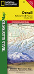
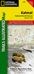
Maps
Kenai Fjords National Park, Resurrection Bay and Seward

The below PDF format maps in this section are for trip planning purposes only.

One of the more current Kenai Fjords topographic maps available for sea kayaking and backpacking navigation is the Trails Illustrated map and is printed on waterproof paper making them ideal for use in Kenai Fjords' wet temperate rainforest environment. The Kenai Fjords National Park Trails Illustrated Map can be purchased from Amazon.

Kenai Fjords National Park Maps
Detailed Aialik Bay Kenai Fjords Camping and Landing Beaches
Abra Cove Camp Map
Bear Cove Camp Map
Coleman Bay Camp Map
Holgate Arm Camp Map
McMullen Cove Camp Map
Pedersen Lagoon Camp Map
Quicksand Cove Camp Map
Tooth Cove Camp Map
Verdant Cove Camp Map

Detailed Harris Bay Northwestern Kenai Fjords Camping and Landing Beaches
Northeastern Glacier Camp Map
Northwestern Glacier Camp Map
Otter Cove Camp Map
Redstone Glacier Camp Map
Southwestern Glacier Camp
Sunlight Glacier Camp Map
Kenai Fjords National Park Maps
Aialik Bay Map
Kenai National Park Map
Private Lands within the Park

Kenai Fjords Food Storage Boxes
Bear Proof Food Boxes Location Map

Hiking Trails
Exit Glacier Trail
Harding Icefield Trail

Kenai Fjords Public Use Cabins Locations
Aialik Bay Cabin
Holgate Cabin

Bear Glacier
Bear Glacier National Park Border

Resurrection Bay Maps
Resurrection Bay Public Use Cabins Locations
Resurrection Bay Cabin
 

Seward Maps
Seward Visitor Maps
Free Downtown Shuttle Map
Seward Walking Map
 
Kenai Fjords National Park Trails Illustrated MapKenai Fjords National Park Trails Illustrated Map

The map includes Kenai Fjords National Park, Kenai national Wildlife Refuge, Chugach National Forest, Harding Icefield, Nuka Island, Kachemak Bay State Park, Ragged Islands, Pye Islands, and more.
Denali National ParkDenali National Park Trails Illustrated Map

The map includes the entire national park area, with a close up view of the area in an around Mount McKinley. It also includes information about Denali National Park and Preserve, as well as useful tips about animal encounters, river crossings, hypothermia, and more.
Katmai National Park Trails Illustrated MapKatmai National Park Trails Illustrated Map

This map includes Katmai National Park, Becharof National Wildlife Refuge, Becharof Wilderness Area, Alaska Peninsula National Wildlife Refuge, Alagnak Wild River Katmai National Preserve, McNeil River State Game Sanctuary, and more.


Alaska Travel hotline

Backcountry Safaris
P.O. Box 1397 Seward, Alaska USA 99664
1-907-205-5900 • Fax 1-907-205-5902
Alaska Cruise Expert


Backcountry Safaris is a member of the following trade and travel organizations:
Anchorage Convention & Visitors Bureeu
Alaska travel package
Kenai Fjords Maps
Kenai Fjords Related Links
Kenai Fjords Wildlife
Kenai Fjords Birds
Suggested Reading
Kenai Fjords Historic Resource Study (online book) by Linda Cook and Frank Norris
Exploring Alaska's Kenai Fjords by David Miller
Kenai Fjords Park - Trails Illustrated Map
Alaska: A History of the 49th State by Claus-M Naske and Herman E. Slotnick
Guide to the Birds of Alaska by Robert H. Armstrong
Wild Flowers of the Yukon, Alaska by John G. S. Trelawny
Kenai Fjords Weather
Current Seward, AK Weather
Click for Seward, Alaska Forecast

Size Of AlaskaDid You Know?
With 570,374 square miles, Alaska is twice the size of Texas and 1/5 the size of the rest of the United States. It stretches 2,400 miles east-to-west and 1,420 miles north-to-south. Its 6,640-mile coastline is 50 percent longer than the combined east and west coasts of the United States.
Copyright 2011 Backcountry Safaris, All Rights Reserved